As you may already know, GeoFlow Public Preview for Excel 2013 has been out for nearly a month now. I have posted a couple of articles on GeoFlow, the Beta version and the Public Preview version. I would like to revisit the Beta post on “What GeoFlow isn’t/doesn’t”. In this post, I would also like to highlight top 5 new features in the Public Preview.
Revisiting The “Not” List
Below is a revised list of what GeoFlow isn’t/doesn’t, for the Public Preview version.
- It does not support SQL Server Geography data type.
It does not support location hierarchy or aggregation level (unlike Power View, where you can double click on Country and it will go to more granular geographical level as long as the model has been setup properly).- It does not work without internet connection. A suggestion on being able to cache the map has bee logged on Connect.
- It does not have a “Z” index. Such information may be handy to map air traffic. This conversation came up during SQL Saturday 177 – super smart audience!
- It does not support elevation information. Another gem that came up at SQL Saturday 177.
- It does not have any tool to export to mp4 or other video file format. Although you can use screen capture software to save the video. This suggestion has been logged on Connect.
- It does not support Chloropleth map.
- Currently GeoFlow does not seem to support discrete GPU; some laptops, Lenovo and Sony VAIO require the discrete GPU to be disabled. This means that it may not be possible to show case GeoFlow on a larger HD display via HDMI. The issue with VAIO laptop has been logged on Connect.
- It does not allow custom map background / ESRI Shapefile. This suggestion has been logged on Connect.
Data refresh is not reflected on the map. A new separate workbook needs to be recreated. GeoFlow seems to import the data from the workbook once. This issue has been logged on Connect.- It does not allow customizable tooltip; i.e. it only uses the information that is used for mapping. This suggestion has been logged on Connect. Update on GeoFlow Preview: A free text form tool tip / annotation box is available though.
- It does not support filtering on Category and Height values. The data must be prepared first for filtering
prior to creating the first GeoFlow map due to the limitation on data refresh as outlined in number 10.This has been logged on Connect. GeoFlow is restricted to 1,048,575 rows (+ 1 table heading row) to be precise. This is because GeoFlow is based only on a table that can be created within Excel 2013.- GeoFlow does not give the option to change the colors used for the markers (bubble or column stack bars) from the default colors associated to the themes. This suggestion has been logged on Connect.
- GeoFlow does not have an “unwrap” option to flatten / view the globe as a whole. This suggestion has been logged on Connect.
New Features
Top 5 new features in GeoFlow Public Preview:
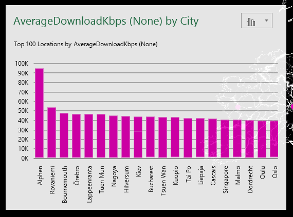
1. Top 100 chart
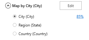
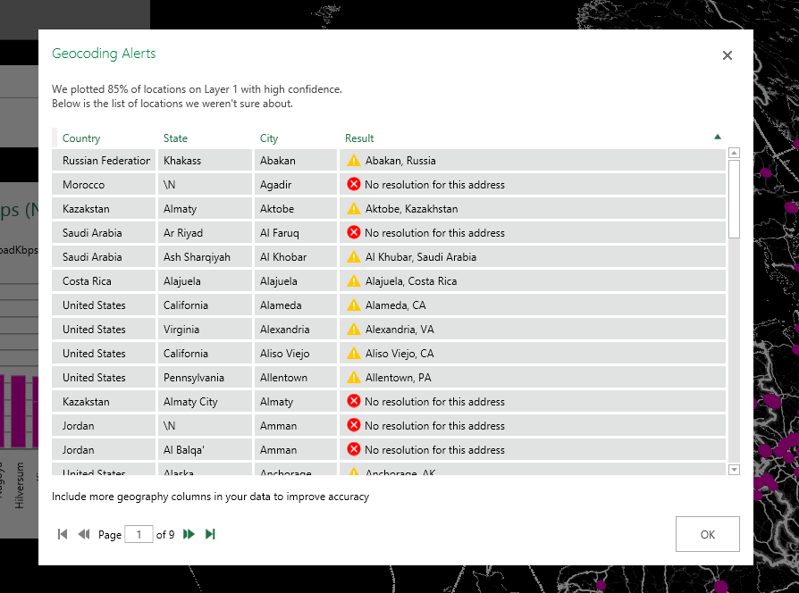
2. Geocoding validation on the selected columns
Clicking on 85% on the example above will display the following Geocoding Alerts window:
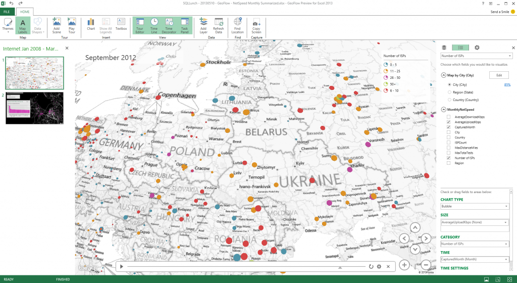
3. Better UI interface
4. Data Refresh
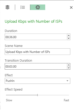
5. Special Effects on tour mode visualization
I will be presenting att SQL Lunch this Friday (May 10, 2013) at 9:30AM PDT to discuss the enhancements and the limitations of current GeoFlow Public Preview for Excel 2013. Hope you can join me then!
Wrap Up
If you are keen on Geospatial reporting, GeoFlow is definitely worth checking out. There are some limitations in the current Public Preview as discussed above. I think now is a great opportunity to test out the Public Preview and providing feedback / suggestions for a better product either via Connect or GeoFlow Forum.
Further Reading
GeoFlow, Is that it, Microsoft? by Jamie Thomson (Worth reading the Comments section)
GeoFlow Product Page on Office.com by Microsoft
GeoFlow Beta – Untapping 3D Visualization by Julie Koesmarno
Public Preview GeoFlow for Excel 2013 by Julie Koesmarno
2 Responses
interesting post!
It’s definitely worth spending some time trying to figure out how BING maps each point as each country has different sets of location hierarchies and, in some cases, using the ‘Other’ type of location could help you get better mapping results. Have you ever tried setting up a column as ‘Other’ before mapping it?
[…] blog1 […]